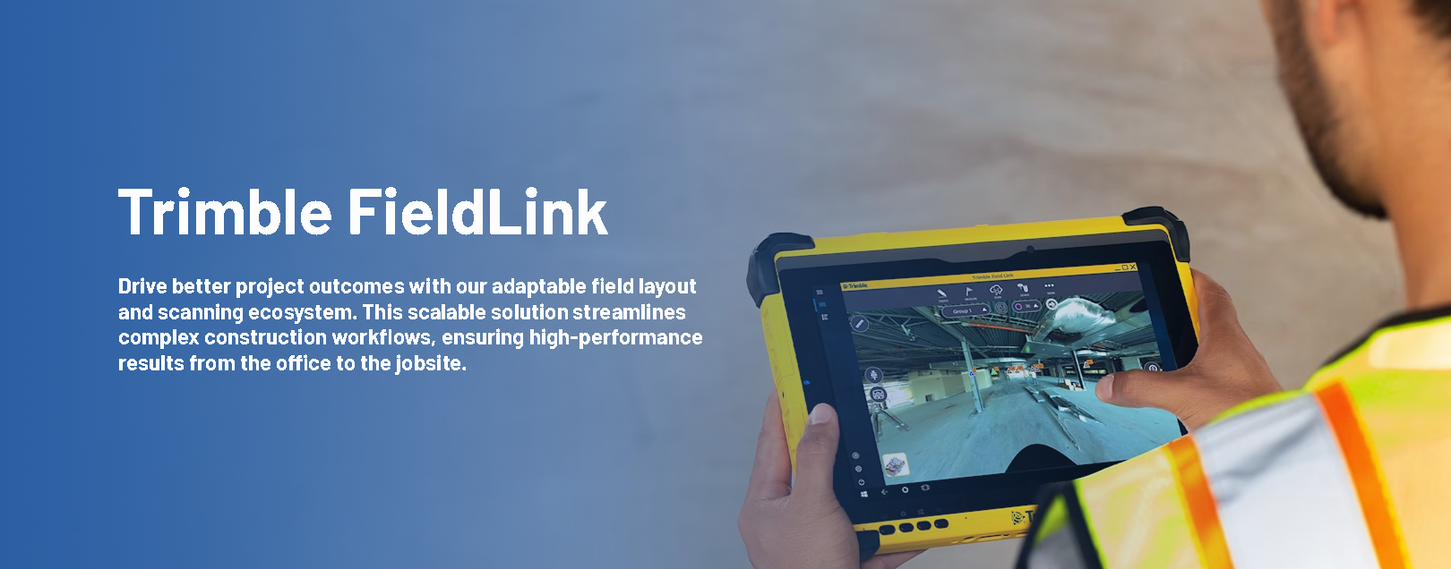
Optimize Your Field Accuracy and Layout Workflows
Discover how our integrated software synchronizes seamlessly across your entire fleet of layout and scanning hardware. Empower your teams to translate complex 3D design data into pinpoint site precision, bridging the gap between digital models and physical construction.
Revolutionize your field operations with an adaptable solution that doubles the efficiency of legacy methods through high-precision automation.
- Elevate Output: Execute high-speed, automated layouts using intuitive, task-driven interfaces and fully customizable user displays.
- Eliminate Costly Rework: Minimize site errors and identify spatial conflicts early with specialized tools built specifically for modern trades.
- Sync Digital & Physical: Bridge the gap between the office and the field by allowing crews to work directly within the 3D model environment.
- Scalable Access: Benefit from flexible licensing tiers designed to grow with your business, featuring instant seat upgrades.
- Simplified Administration: Manage your team seamlessly with cloud-based identity tracking, device-to-device transfers, and detailed activity analytics.
One solution for all field layout and scanning tasks
Accurate layout
Control robotic total stations or GNSS receivers to precisely lay out from models or created lines.
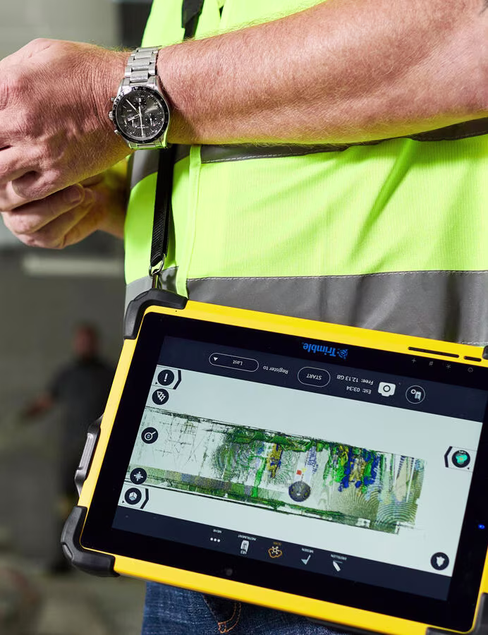
Quick and efficient scans
Collect points, lines and curves to create 3D as-builts or surface analysis.
Easy as-built collection
Collect as-built points with Trimble Ri or RTS series robotic total stations, ensuring real-time model accuracy.
In-field 3D scanning registration
Leave the jobsite with an automatically registered point cloud aligned to your design model, ready for export to CAD programs for as-built analysis and application.
Stop Chasing Rework. Start Scaling Accuracy.
Ready to see how Trimble FieldLink can cut your layout time in half? Our local Intermountain team is ready to help you integrate the industry’s leading hardware and software into your specific workflow.